Visualize Your Roadways
Mandli's All-in-One Solution

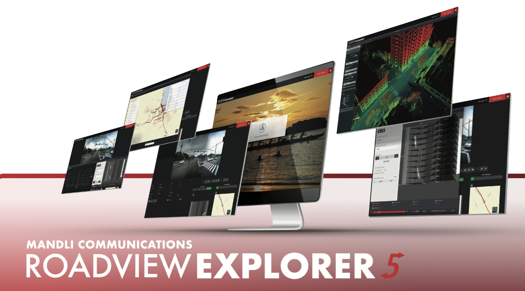
To remain efficient and cost-effective, transportation agencies need the most information they can get from their data. That’s why Mandli created Roadview® Explorer, to give users the flexibility to view their data in an intuitive and accessible platform.
Web-enabled access allows users to view the data anytime, anywhere.
Benefits of a Web-Based Platform
Accessible Data
With URL access your roadway data is accessible from anywhere, no additional software installation or IT resources required. Available on a majority of platforms, including Google Chrome and Firefox.
User-Friendly
Roadview Explorer is designed for users to get the most out of their data without requiring vast knowledge or experience.
User-friendly layout and controls feature:
- Flip view and look at the opposite direction, if collected
- Easy location referencing and navigation
- Forward, reverse, and step play control
- Map search functionality
- Play speed control
- Thumbnail images to increase the speed of playback
Fully-Integrated Interface
Roadview Explorer seamlessly integrates all of your roadway data into an intuitive point and click interface.
Data elements include:
- High-Resolution Right-of-Way Images
- 3D Pavement Images
- Pavement Condition Data
- GPS Data
- LiDAR Point Cloud Data
- Asset data viewable in Esri Maps and the LiDAR Point Cloud
- Centerline Maps
With all of the data matching a single GPS point, Roadview Explorer can display any geo-referenced data, even data not collected by Mandli.
Drive, View, and Measure Assets
Roadview Explorer provides an interactive environment with un-paralleled functionality including search and playback features for 360° images. Users can view and measure assets using LiDAR and view the downward pavement images and distress data for any spot on the roadway.
For more information on how Mandli can customize a web-based solution to fit your agency's needs, please reach out to one of our representatives.
